
Crews continue to battle the Marks Creek Fire under critical weather, steep terrain, and shifting conditions. Firefighters are working around the clock to construct and strengthen containment lines across the fire.
On the north and northeast flanks, crews have completed both line construction and hose lay. However, access to these areas was slowed Friday due to the need to mitigate hazardous snags and safety concerns from ongoing thunderstorms.
Containment lines have also been established and plumbed with hose on the southwest side of the fire. Despite this progress, challenging terrain continues to limit interior access, making direct engagement difficult. Crews patrolled the fire perimeter throughout the night.
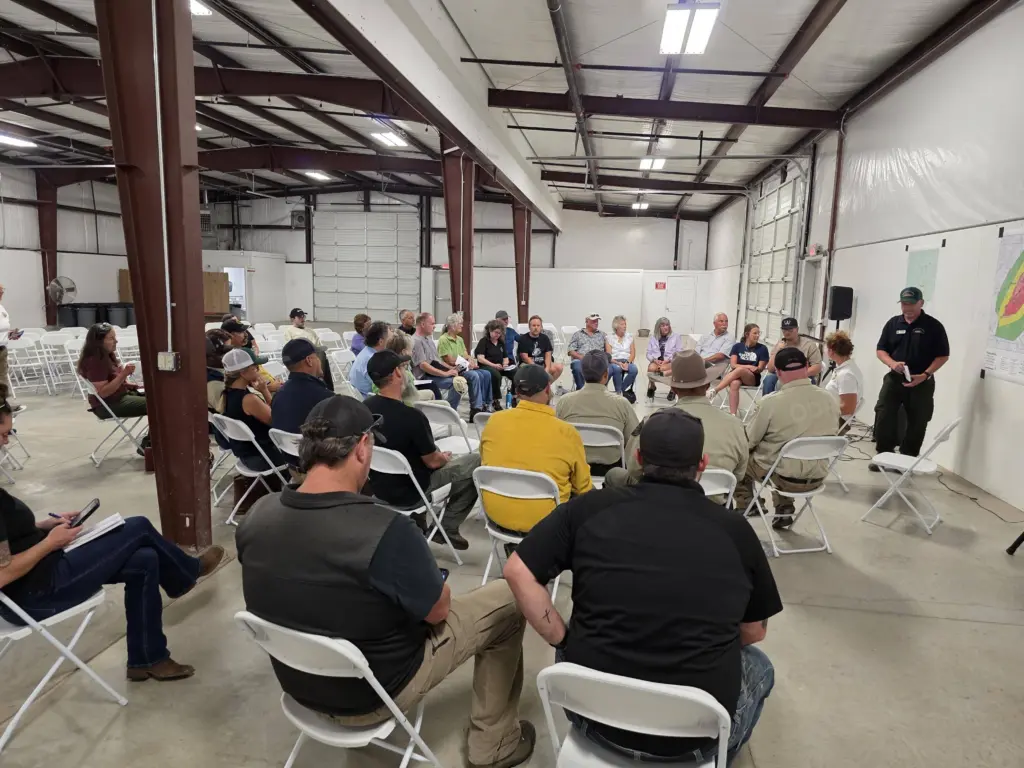
COMMUNITY MEETING: ODF IMT2 hosted a successful community meeting, providing residents with current information and an opportunity to engage directly with fire officials. The team would like to thank everyone for their continued support. To view the recording of the meeting, please visit the Marks Creek Fire Facebook page.
All responding agencies are coordinating closely to protect lives, property, natural resources, and nearby communities. The safety of firefighters and the public remains the highest priority.
Highway 26 remains open; however, firefighters and heavy equipment are working along the roadway. Please drive with caution and stay out of the fire area to support fire operations and ensure firefighter safety.
Evacuations: Crook County Sheriff’s Office evacuation orders remain in place. An evacuation map is available through the Crook County Emergency Management Office website.
The Ochoco National Forest has implemented an area and road closure on the Lookout Mountain Ranger District in response to the Marks Creek Fire. The closure is necessary to protect the public and provide a safe environment for firefighters as they continue suppression efforts. Forest officials recognize that this closure impacts local communities, in particular hunters, campers, and other visitors during a busy recreation season.
The closure area is east of Prineville and includes portions of the forest near the Ochoco Ranger Station Road, Highway 26, and surrounding forest roads. The order restricts access to roads, trails, and developed recreation sites within the fire footprint and adjacent areas where fire crews are actively working. The closure will remain in effect until conditions allow for safe reopening.
Closure Details
The closure area is bounded by Highway 26, Ochoco Ranger Station Road, and Forest Service Roads 2610 and 2610-150. Within this area, the following are closed:
- Forest Service Road 3300-500
- The Forest Service Road 3350 network
- Ochoco Forest Campground (including the entirety of FSR 2610-400)
- White Rock Campground
Maps of the closure boundary are available on the Ochoco National Forest website.
Public Safety First
Closures such as this are difficult but necessary. They allow firefighters to focus on suppression efforts and ensure the public stays out of harm’s way. The Ochoco National Forest will reduce or lift the closure as soon as fire activity and conditions make it safe to do so.
Closure maps and additional details are available at the Ochoco National Forest website, https://www.fs.usda.gov/r06/ochoco/alerts/marks-creek-fire-area-closure
-0-
The Blackrock fire which was started by a lightning strike near Blackrock, North of Hwy 218 (Shanico-Fossil Hwy) next to the John Day River is approximately 18,000 acres and has no containment or perimeter around the fire.
A Central Oregon Type 3 Incident Management Team arrived and established the Blackrock ICP at Pine Creek Conservation Area on Friday September 5, 2025 at 1300hrs. The fire had an Initial Attack of 4 crews, 7 engines, 1 water tender, 3 skidgeons and 20 overhead to take command of the incident. As of the first operational period there were 153 personnel on the Blackrock Fire. On September 5, 2025 during the day the fire had pushed forward 100 acres for a total of 3400 acres. In the late evening of September 5, 2025 the fire pushed forward several miles due to erratic winds, and thunder storms and is now approximately 18,000 acres in size with smoke and fire visible from Hwy 97. No structures were lost or threatened, and additional personnel and equipment were ordered by Central Oregon Type 3 IMT to manage the incident.
Today, resources will continue to prioritize Firefighter and Public Safety, mitigation of the fire with acknowledgment and consideration for residents and culturally protected areas. The Incident is also in coordination and involvement with local owners and cooperators.
We advise that recreational usage in the John Day River area from Hwy 218 (Shanico-Fossil Hwy) North, East and West of the John Day River near Blackrock is utilized with extreme caution due to Firefighting and Aircraft usage in this area. Accessing this area could be very hazardous to individuals and firefighters due to firefighting activities.
Residents are encouraged to stay updated and follow any directions from fire in the area or vicinity.
Evacuations are not in place in the Wasco County area near Blackrock. For up-to-date evacuation information and to receive emergency notifications in Wasco, Wheeler or Grant Counties, Visit: OR-Alert.gov OR
Visit the official source for wildfire information in Central Oregon at Centraloregonfire.org for wildfire updates or follow fire information on X/Twitter @CentralORfire. Call 9-1-1 to report a wildfire. For smoke and air quality information please visit fire.airnow.gov
Please refrain from flying drones in or near the fire area. Unauthorized drones can ground firefighting aircraft and delay suppression efforts.